Enhancing Solar Site Assessment with 3D Point Cloud Scanning
What is LiDAR?
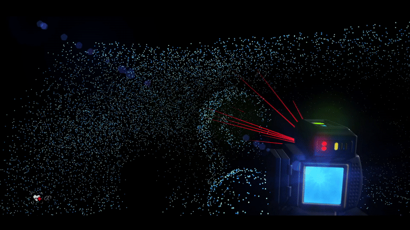
LiDAR (Light Detection and Ranging) is a remote sensing method that uses laser light to measure distances with high precision, creating accurate 3D representations of environments.
How It Works
Emits rapid LASER pulses toward a surface
Measures time taken for each pulse to return (Time of Flight)
Calculates precise distance and maps millions of data points
Outputs a detailed 3D Point Cloud Data (PCD) of the scanned area
Extracting Accurate Roof Details in Minutes: A Case Study
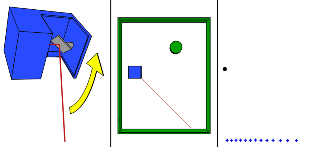
Step 1: Scanning
Site Walkthrough with Handheld LiDAR Scanner
Perform a walkthrough of the site using a handheld LiDAR scanner
The device captures millions of data points per second, enriched with RGB imagery, to create a high-fidelity digital representation of the environment
Step 2: Data Register
Register Data to the Cloud & Cleaning
Seamlessly upload the captured point cloud data to a centralized cloud platform
Use specialized software to clean noise, align scans, and geo-reference the data to the site’s coordinates
Step 3: Modelling
Generate 2D and 3D Site Models with Obstruction Mapping
Convert the processed LiDAR data into precise 3D/2D models of the site, including roof geometry, elevation profiles, and obstructions such as HVAC units, skylights, and shading elements
These models serve as the foundation for solar design and system layout
Best-Fit Scanners for Different Roof Sizes
Small Roofs (~5,000 ft²): Matterport Pro3, GeoSLAM ZEB
Medium to Large (~20,000–50,000 ft²): FARO Focus, GeoSLAM ZEB
Very Large (~100,000 ft²): FARO Focus for max accuracy, GeoSLAM for speed
Each scanner balances cost, speed, and precision, making it easy to scale across project types.
Applications Across the Solar Lifecycle
Site Assessment: Virtual walkthroughs enable remote collaboration and planning.
Design & Optimization: Accurate shading and irradiance analysis.
As-Built & QA: Robust documentation before and after installation.
rProcess is at the forefront of integrating cutting-edge scanning with solar design. With our Scan-to-CAD approach, we’re not just capturing data—we’re accelerating solar deployment, improving design accuracy, and enabling smarter decisions from day one.